Flash Flood Tips
Pay attention to barricades. Don't ignore them by driving past them. Avoid driving through standing water. Water's powerful force can easily overtake vehicles caught in a flood. The average automobile can be swept off the road in 12 inches of moving water, and roads covered by water are prone to collapse. Attempting to drive through deep water also may stall your engine, with the potential to cause irreparable damage if you try to restart the engine. If you come upon a flooded street, try to take an alternate route. Take extreme precaution while driving . Avoid driving in water with downed electrical or power lines. Stay off your phone unless you must report severe injuries. If you become trapped in rising water, immediately abandon your car for higher ground. If you can't get out of your car safely, call 911 or get the attention of someone for help.
Pay attention to barricades. Don't ignore them by driving past them. Avoid driving through standing water. Water's powerful force can easily overtake vehicles caught in a flood. The average automobile can be swept off the road in 12 inches of moving water, and roads covered by water are prone to collapse. Attempting to drive through deep water also may stall your engine, with the potential to cause irreparable damage if you try to restart the engine. If you come upon a flooded street, try to take an alternate route. Take extreme precaution while driving . Avoid driving in water with downed electrical or power lines. Stay off your phone unless you must report severe injuries. If you become trapped in rising water, immediately abandon your car for higher ground. If you can't get out of your car safely, call 911 or get the attention of someone for help.

The gates to the Cedar Valley Reservoir have been reopened. Be advised that water levels are still high, but not covering the road at this time.
Oak Street is now open to through traffic. Thank you for your patience while road repairs were made.

Beginning Tuesday, June 2, 2026, Oak Street will be temporarily closed to through traffic from Park Rd to the Auto Tech school for road repairs. Please use alternate routes while work is being done. We appreciate your patience.

For safety reasons, the gates to the south side of the Cedar Valley Reservoir have been closed due to high water levels and water over the road. We apologize for the inconvenience, and will let you know when the gates reopen. Please share!
All electric services have been restored.. if you are without electricity, please notify dispatch, as it will be unrelated to the previous outage. Thank you again. For your patience.
The crews continue to work to get power restored. We know it is frustrating, and we appreciate your patience while repairs continue to be made. There is no ETA as to when 100% of customers will have power restored, but we will continue to update as information becomes available.
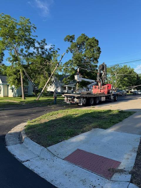
We are aware of the power outage, and crews have been dispatched for repairs. Poles and lines are down, and we do not have an ETA on when repairs will be completed.
Gas will be off on Hayes St. between 4th Avenue and 7th Avenue while they work to repair the gas line. We apologize for the inconvenience.

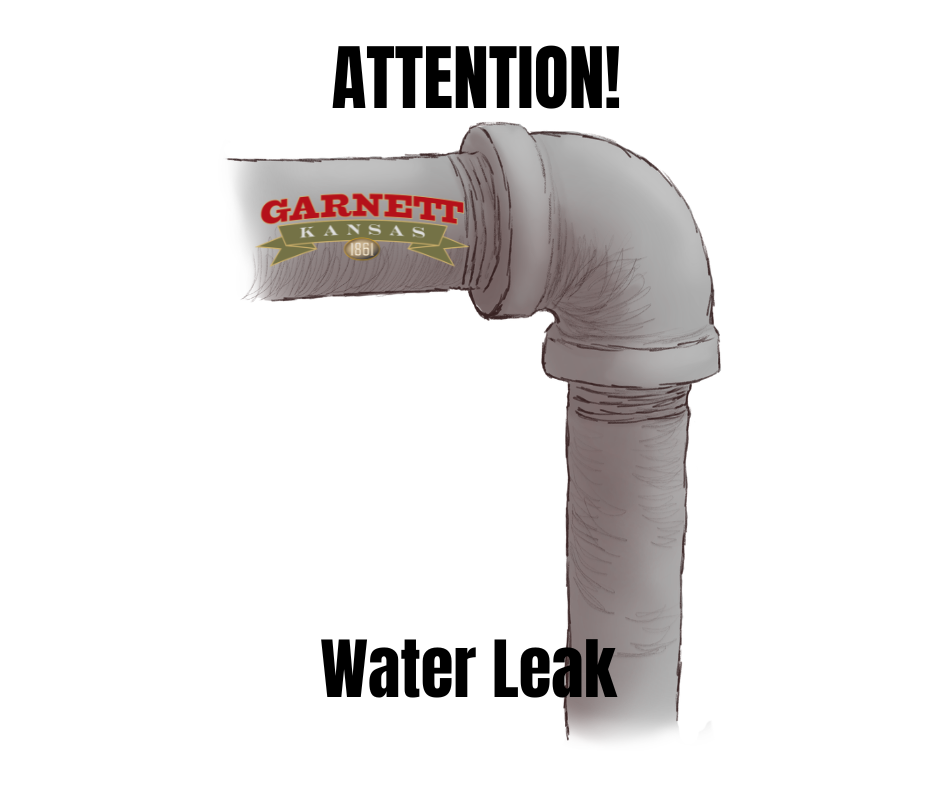
Water service has been restore in the 100-200 blocks of west 2nd Avenue and the 200-300 blocks of south Oak St. Thank you for your patience.
The water service at the 100-200 blocks of West 2nd Avenue and the 200-300 blocks of S. Oak Street will be temporarily shut off so that additional work can be done. We apologize for the inconvenience.

The water leak at the 100-200 blocks of West 2nd Avenue and the 200-300 blocks of S. Oak Street was repaired by 9 p.m. last night. We thank you for your patience while work was being done, and great job to the crews who got it taken care of prior to the storm!
BULLETIN - IMMEDIATE BROADCAST REQUESTED
Severe Thunderstorm Warning
National Weather Service Topeka KS
816 PM CDT Thu Apr 23 2026
The National Weather Service in Topeka has issued a
* Severe Thunderstorm Warning for...
Southern Franklin County in east central Kansas...
Northern Anderson County in east central Kansas...
Southern Osage County in east central Kansas...
Coffey County in east central Kansas...
* Until 915 PM CDT.
* At 815 PM CDT, a severe thunderstorm was located 6 miles northwest
of New Strawn, moving east at 45 mph.
HAZARD...70 mph wind gusts and penny size hail.
SOURCE...Radar indicated.
IMPACT...Expect considerable tree damage. Damage is likely to
mobile homes, roofs, and outbuildings.
* Locations impacted include...
Garnett, Burlington, Lebo, Waverly, Richmond, Williamsburg, New
Strawn, Melvern, Hartford, Greeley, Princeton, Lane, Rantoul,
Westphalia, Olivet, Beto Junction, Harris, John Redmond Reservoir,
and Melvern Lake.
This includes Interstate 35 between mile markers 144 and 177.
PRECAUTIONARY/PREPAREDNESS ACTIONS...
For your protection move to an interior room on the lowest floor of a
building.
A Tornado Watch remains in effect until 900 PM CDT for east central
Kansas.
&&
LAT...LON 3818 9508 3818 9596 3851 9595 3856 9506
TIME...MOT...LOC 0115Z 264DEG 37KT 3834 9580
THUNDERSTORM DAMAGE THREAT...CONSIDERABLE
HAIL THREAT...RADAR INDICATED
MAX HAIL SIZE...0.75 IN
WIND THREAT...RADAR INDICATED
MAX WIND GUST...70 MPH
Water service will be shut off in the 100-200 blocks of West 2nd Avenue and the 200-300 blocks of S. Oak Street. We are sorry for the inconvenience. It is anticipated that service will be interrupted for between 4-5 hours. We appreciate your patience while repairs are being made.

THE NATIONAL WEATHER SERVICE HAS ISSUED TORNADO WATCH 136 IN EFFECT UNTIL 9 PM CDT THIS EVENING FOR THE FOLLOWING AREAS
IN KANSAS THIS WATCH INCLUDES 23 COUNTIES
IN CENTRAL KANSAS
DICKINSON
IN EAST CENTRAL KANSAS
ANDERSON COFFEY DOUGLAS FRANKLIN GEARY LYON MORRIS OSAGE SHAWNEE WABAUNSEE
IN NORTH CENTRAL KANSAS
CLAY CLOUD OTTAWA REPUBLIC WASHINGTON
IN NORTHEAST KANSAS
BROWN JACKSON JEFFERSON MARSHALL NEMAHA POTTAWATOMIE RILEY
THIS INCLUDES THE CITIES OF ABILENE, ALMA, ALTA VISTA, BELLEVILLE, BENNINGTON, BLUE RAPIDS, BURLINGAME, BURLINGTON, CARBONDALE, CLAY CENTER, CLIFTON, CONCORDIA, COUNCIL GROVE, EMPORIA, ESKRIDGE, FRANKFORT, GARNETT, GRANTVILLE, GREENLEAF, HANOVER, HARVEYVILLE, HERINGTON, HIAWATHA, HOLTON, HORTON, JUNCTION CITY, LAWRENCE, LEBO, LINN, LYNDON, MANHATTAN, MAPLE HILL, MARYSVILLE, MCFARLAND, MCLOUTH, MERIDEN, MINNEAPOLIS, NORTONVILLE, OSAGE CITY, OSKALOOSA, OTTAWA, OVERBROOK, PAXICO, PERRY, SABETHA, SENECA, ST. MARYS, TOPEKA, VALLEY FALLS, WAMEGO, AND WASHINGTON.
Repaving on 2nd Avenue from Oak Street to Maple Street-UPDATE
The intersection of Maple Street and 2nd Avenue on the east side of Maple Street is currently closed. Oak Street and 2nd Avenue is opened, but the road is very rough as bricks have been removed, so proceed with caution. If you live in this area, please use alley for parking when possible.
The intersection of Maple Street and 2nd Avenue on the east side of Maple Street is currently closed. Oak Street and 2nd Avenue is opened, but the road is very rough as bricks have been removed, so proceed with caution. If you live in this area, please use alley for parking when possible.
From National Weather Service · Last updated 12 mins ago
THE NATIONAL WEATHER SERVICE HAS ISSUED TORNADO WATCH 130 IN
EFFECT UNTIL 9 PM CDT THIS EVENING FOR THE FOLLOWING AREAS
IN KANSAS THIS WATCH INCLUDES 12 COUNTIES
IN EAST CENTRAL KANSAS
ANDERSON COFFEY DOUGLAS
FRANKLIN LYON MORRIS
OSAGE SHAWNEE WABAUNSEE
IN NORTHEAST KANSAS
BROWN JACKSON JEFFERSON
THIS INCLUDES THE CITIES OF ALMA, ALTA VISTA, BURLINGAME,
BURLINGTON, CARBONDALE, COUNCIL GROVE, EMPORIA, ESKRIDGE,
GARNETT, GRANTVILLE, HARVEYVILLE, HIAWATHA, HOLTON, HORTON,
LAWRENCE, LEBO, LYNDON, MAPLE HILL, MCFARLAND, MCLOUTH, MERIDEN,
NORTONVILLE, OSAGE CITY, OSKALOOSA, OTTAWA, OVERBROOK, PAXICO,
PERRY, TOPEKA, AND VALLEY FALLS.
Beginning Monday, April 20, 2026, 2nd Avenue from Oak Street to Maple Street will be closed to through traffic for repaving. Please use alternate routes.

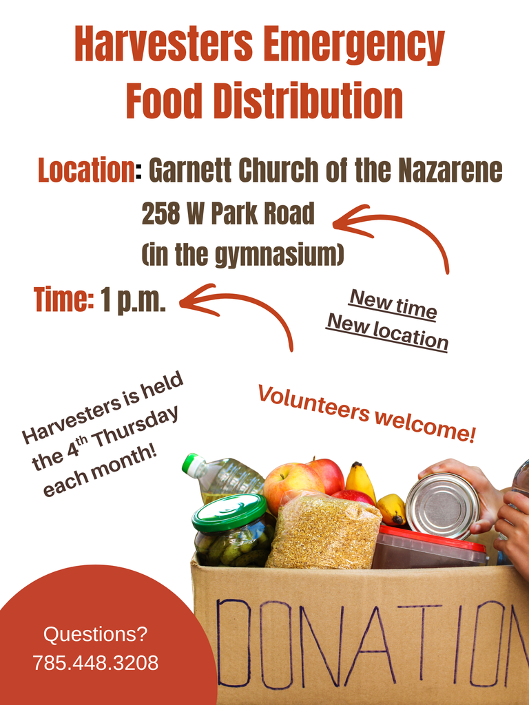
There have been some changes to Harvesters Emergency Food Distribution. It will be held at the Garnett Church of the Nazarene in the gymnasium on the 4th Thursday of each month at 1 p.m. Please spread the word! The next Harvesters will be held on April 23 at 1 p.m. at the Garnett Church of the Nazarene. Please share, as we want to reach EVERYONE, so that no one goes hungry!
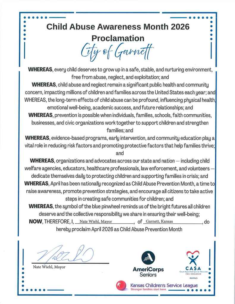
National Child Abuse Prevention Month (NCAPM), dedicated to raising awareness, strengthening families, and preventing child maltreatment through community action. It highlights the blue pinwheel as a symbol of healthy childhoods, encouraging actions like wearing blue, donating, and implementing prevention programs.